A Community Wildfire Protection Plan (CWPP) was presented to the community at an open house on Jan. 30.
The plan was nearly 18 months of work for Crissy Bennett and Chad Lantz, who developed the plan, with consultations with Ministry of Forests Wildfire Protection Branch personnel and others.
The plan is a joint project by the District of Fort St. James and Nak'azdli Band, and looked at wildfire risk to the community, recommending actions and initiatives to address this risk and education plans for the public on the risk as well as to encourage cooperative planning of land use and public services to minimize the risk.
The Regional District of Bulkley Nechako declined involvement with the plan, but said they were supportive of it in principal. Their lack of involvement, however, limited the areas examined in the plan to Indian Reserve (IR) Land and parts of the District of Fort St. James.
The goals of the plan were to determine the wildfire risk to the community, recommend actions to mitigate this risk, educate the public about wildfire risk, and encourage cooperative planning of land use and public services to minimize the impacts of wildfires in the future.
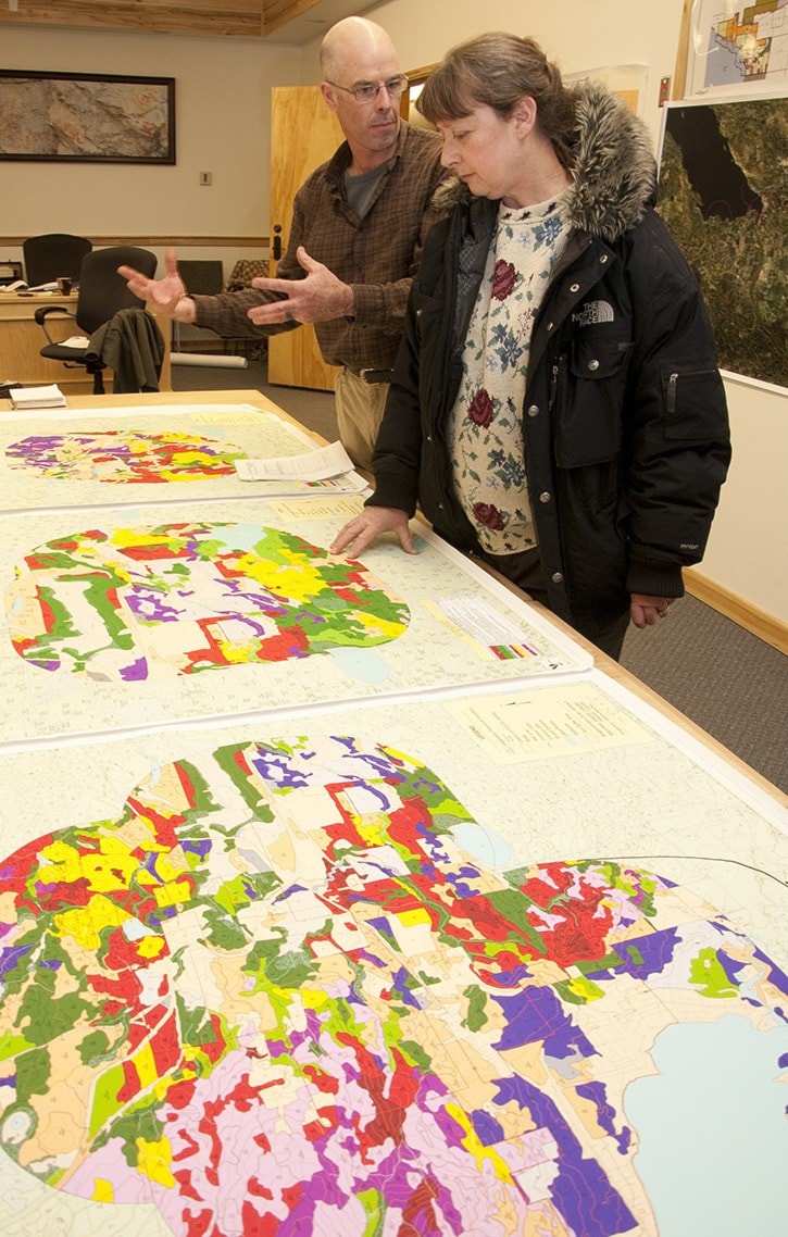
The plan looked at IR land on Sowchea Road near Sowchea Creek, Six-Mile Meadow south of Fort St. James (near the Yellowhead Road and Bridge pit), Nak'azdli Reserve, the District of Fort St. James, Williams Prairie Meadow, and the Apollo Mill plus a two-kilometre buffer around each of these areas.
The entire area was then broken up into seven "planning units" which were assessed for their wildfire risks to the infrastructure, using factors like forest types, density, climate zone, slope, structures and historical fire occurrences.
With low fire occurrences and less volatile fuel types, the research did not uncover any areas of high concern, according to Lantz. After analysis, the wildfire threat class found around the community in all the planning units was moderate.
Historically, Fort St. James has a fire occurrence in the same range as coastal B.C., which are very sporadic fire starts, which is good news for the community.
After presenting the plan to the community, and getting input from both Nak'azdli Chief and council and Fort St. James Mayor and council, the plan will be finalized and submitted back to both councils and then the province before implementation.
The plan will take three to five years to implement, and would then be monitored annually.
One of the biggest parts of the plan which can be moved on right away and will not require extensive funding or additional resources will be the public education on "Fire Smart" principles for homeowners in the area which help reduce the fire risk to structures.
"From my perspective … the FireSmart protection is critical," said Lantz. He said while the area around the community could be addressed by fuel management work, which is expensive and time-consuming, if homeowners do not deal with issues on their own property, the work done outside private property is not effective.
Community member Joanne Vinnedge attended the open house to learn about the wildfire plan, and to express her concern recreational values were not being taken into consideration with the planning.
Specifically in the area behind Sowchea Bay, Vinnedge pointed out the high value of the trail networks and extensive use by area residents, which if fire risk was addressed by tree clearing, could be jeopardized.
The draft Fort St. James and Nak'azdli Community Wildfire Protection Plan is available at the District of Fort St. James office for review.